Geology program to tell story of the land

Geology is the study of the earth, it land and its rocks, to try a piece together the mysteries of how it all came to be. A special program about Iowa landscapes, and specifically Marshall county landforms, will be presented by Phil Kerr, who grew up near Dunbar, IA, attended East Marshall high school, and is now a geologist working for the Iowa Geological Survey. Kerr likes to use state-of-the-art mapping technology, and other research tools, to unlock the mysteries of how land forms were created over immense spans of time that included numerous glacial and interglacial episodes, shallow warm water oceans coming and going, and plate tectonics forces. Kerr’s free program will be held at the Grimes Farm shelter house on Sept. 28, a Tuesday, from 11:30 to 12:30.
GEOLOGY is a very interesting topic of science investigation. Clues are everywhere on the landscape, in its soil profiles, and in buried rock layers underlying all of the Midwest and Iowa. Deciphering those clues is in part what geologists do. Geologists have long recognized the value of understanding, or at least trying to understand, how our earth was put together. It is that understanding that helps humans find water, find and use resources that allow us to thrive and survive, to find resources to use for construction, and to grow in our knowledge of proper stewardship methodologies to conserve soil, air and water. Understanding how our earth functions and responds to galactic sized forces of nature is a big clue to trying to forecast events in earth’s future.
Phil Kerr and I exchanged several e-mail conversations last year. And the bug was planted to come back to Marshall County to present an informational program about local landforms. Kerr was given contact information at the Marshall County Conservation Board to arrange a program. I am glad to know that this worthwhile program will help inform all who attend about geological forces that made Marshall County what it is today. Phil Kerr will explain and provide a quick summary of bedrock and glacial geology. He will also talk about the Iowa River and its history with regard to land forms.
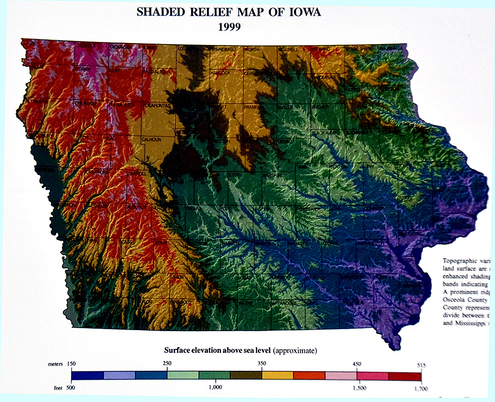
In today’s large map of the Midwest, the map type is called hillshade. This type of land form depiction emphasizes topographic features and elevation differences. It becomes easy to recognize patterns on the land as if an astronaut in their space station observatory could look down on us on a cloudless day to make such a photograph. Well, this is not how this composite image was created, but you get the idea. This picture allows us, and especially geologists, to tell stories and make interpretations of land forms from long long ago.
Note the heavy black line that traces and points out the last glacial maximum (LGM) of the Wisconsinan glacial episode. Everything north of the black line was glacial ice. And that glacial ice covering northern North America stretched from Washington State, Idaho, Montana, the Dakotas, Minnesota, Iowa, Wisconsin and eastward all the way into the northeast all the way to Newfoundland. The name geologist have given to this ice is the Laurentide Ice Sheet.
During just the past 2.9 million years, the climate of the Northern Hemisphere has fluctuated between conditions of warm and cold. According to the Wisconsin Geological Natural History Survey, Division of Extension, University of Wisconsin-Madison, these cycles are the result of changes in the shape of Earth’s orbit and the tilt of the Earth’s axis. Colder periods allowed for the expansion of glaciers over large segments of the North American continent. And Nick Zentner, geologist at Central Washington University, notes that during those past 2.9 million years, 33 glacial cycles have come and gone, each a bit different in duration and flow, and each inter-glacial warming between advances of ice were also not all equal. The point to be made is the effect those glacial system advances and retreats had that shaped the terrain of North America.
Changes in climate, all natural, huge, and unstoppable, have followed a regular pattern for the past 700,000 years. Each cycle tends to last about 100,000 years and consisted of a long period of generally cooling climate during which glaciers grew, followed by shorter periods of conditions similar to or warmer than those today. PS. If this is the trend of huge natural Earth climate cycles, then why do major media outlets today continue to try to indoctrinate us that humans are the cause of climate change? Because they lie to us, ignore facts, ignore science, and use misinformation for political power purposes, in false hopes of somehow spending our money on schemes that are not in touch with reality.
The U of Wisc-Madison article continues it is analysis of the most recent glacial event. At about 100,000 years ago, the climate cooled again and ice spread across the continent. A major ice advance at 31,500 years ago spread across Wisconsin and continued its expansion for 13,500 years before temperatures warmed again. That warming triggered glacial ice retreat (melting faster than any forces to advance). A similar story of glacial ice in north-central Iowa can be told from ice coming from Minnesota. And a similar story exists for the James Lobe of ice in eastern Dakota states. Where the glacial ice traveled, or where it did not flow, were partially due to underlying landscape features. High lands diverted glacial ice into lobes, or tongues or fingers, so the ice followed paths of least resistance onto lowlands.
The amount of water locked in the Laurentide Ice Sheet was tremendous. As the climate naturally warmed, ice melted over time spans of thousands of years. However, the water released altered landscapes of any territories below the once prominent ice LGM. River courses were cut into exposed glacial tills of ground up rock and debris. Valleys were defined by water and those valleys filled with silts, clays, sands and gravels. Tundra-like vegetation finally took root. And as warmer climates began to dominate, boreal forests thrived, only to give way in time to a mix of deciduous trees, and ultimately grass dominated landscapes in the Midwest.
On today’s large map, also note the dark dotted line going through eastern Nebraska, northeast Kansas, Missouri, Illinois, Indiana and into Ohio. That dotted line represents another glacial time frame with maximums way older than the Wisconsinan system. Geologists label those times as pre-Illinois episodes. Indeed, our landscape has been shaped by past geologic events of extremely long time frames. The red line in eastern Iowa depicts a former location of a portion of the Mississippi River. It is amazing the amount of information that can be discovered from an incredibly detailed map like the one you are looking at today.
And since our human life times are very short, where it is easy to ignore the past, it will be beneficial for us to know that Nature Rules. We can only adapt. Geology says that “the present is the key to the past.” Let us learn the facts that made our landscape what it is.
To attend this free geology program, call the conservation board office at 641-752-5490 to register. Please do so prior to Sept. 23 at 4 P.M.. for the program date of Sept. 28, 11:30 to 12:30. Come see and learn for yourself what geology can tell us. Learn what a geologists sees that we need to know. Enjoy life long learning.
Quote to remember: ” People try to do all sorts of clever and different things to improve life instead of doing the simplest thing — refusing to participate in activities that make life bad.”
– Leo Tolstoy, writer.
Garry Brandenburg is the retired director of the Marshall County Conservation Board. He is a graduate of Iowa State University with a BS degree in Fish & Wildlife Biology.
Contact him at:
P.O. Box 96
Albion, IA 50005
-

- Geology is the study of the earth, it land and its rocks, to try a piece together the mysteries of how it all came to be. A special program about Iowa landscapes, and specifically Marshall county landforms, will be presented by Phil Kerr, who grew up near Dunbar, IA, attended East Marshall high school, and is now a geologist working for the Iowa Geological Survey. Kerr likes to use state-of-the-art mapping technology, and other research tools, to unlock the mysteries of how land forms were created over immense spans of time that included numerous glacial and interglacial episodes, shallow warm water oceans coming and going, and plate tectonics forces. Kerr’s free program will be held at the Grimes Farm shelter house on Sept. 28, a Tuesday, from 11:30 to 12:30.

Outdoors Today

Northern Pike eggs now in Spirit Lake hatchery

Robins adapt to March’s variable weather

Sportsman’s sale at Ikes April 5-6

Wildlife taxidermy art on display March 23

Waterfowl wonders: many species are on the move
